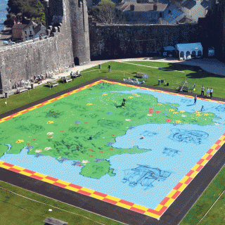
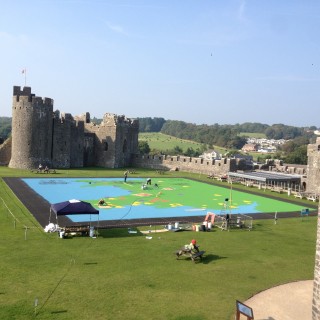
The Great Map of Wales
As part of a suite of new visitor interpretation at Pembroke Castle in Pembrokeshire, Hotrod is creating The Great Map of Wales to let visitors take a walk through medieval history. The painted map covers over 1000m2 and shows the principal castles of the native Welsh princes, the invading Norman lords, and the Anglo-Norman kings who eventually conquered the territory. The design has a very medieval feel, with decorative details of chain-mailed soldiers, fire-breathing dragons a huge sea serpent crushing a ship. … SEE MORE