Thursday 11th September 2014
The Great Map of Wales
![]()
![]() SHARE THIS STORY
SHARE THIS STORY
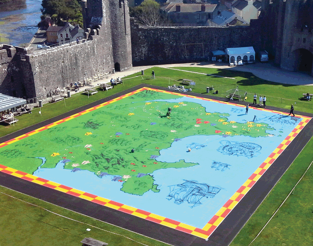
As part of a suite of new visitor interpretation at Pembroke Castle in Pembrokeshire, Hotrod is creating The Great Map of Wales to let visitors take a walk through medieval history. The painted map covers over 1000m2 and shows the principal castles of the native Welsh princes, the invading Norman lords, and the Anglo-Norman kings who eventually conquered the territory. The design has a very medieval feel, with decorative details of chain-mailed soldiers, fire-breathing dragons a huge sea serpent crushing a ship.
Interpretation tables next to the map help visitors and school groups step through the cycles of invasion and resistance that characterised three centuries Welsh history. It is hoped that this engaging exhibit will resonate all audiences with the complexities and richness of medieval history.